Land Navigation Basics Without GPS
Lose cell service on a back road, drift off a marked trail, or hit a dead battery in bad weather, and land navigation basics without GPS stop being a hobby skill fast. They become a real-world way to get yourself home. The good news is you do not need to be a mountaineer or a former scout leader to learn this. You need a few solid tools, a simple process, and enough practice to stay calm when your phone quits.
Most people overcomplicate land navigation because they start with advanced map work before they can do the basic stuff under stress. That is backwards. If your goal is to move through woods, backroads, public land, or unfamiliar terrain without wandering in circles, start with four things: a paper map, a baseplate compass, pace count, and terrain awareness. Real survival info. Real gear. No BS.
What land navigation basics without GPS really means
At the beginner level, this skill is not about plotting perfect military-style routes across huge distances. It is about knowing where you are, where you need to go, and how to move there without guessing. Sometimes that means following a bearing through timber. Sometimes it means using a ridgeline, creek, fence line, or road as a handrail and staying oriented the whole time.
The biggest mistake beginners make is trusting one method too much. A compass matters, but a compass alone will not save sloppy thinking. A map helps, but only if you keep matching the map to what is around you. Good navigation is layered. You use the map, compass, terrain, distance, and common sense together.
The only gear you need to start
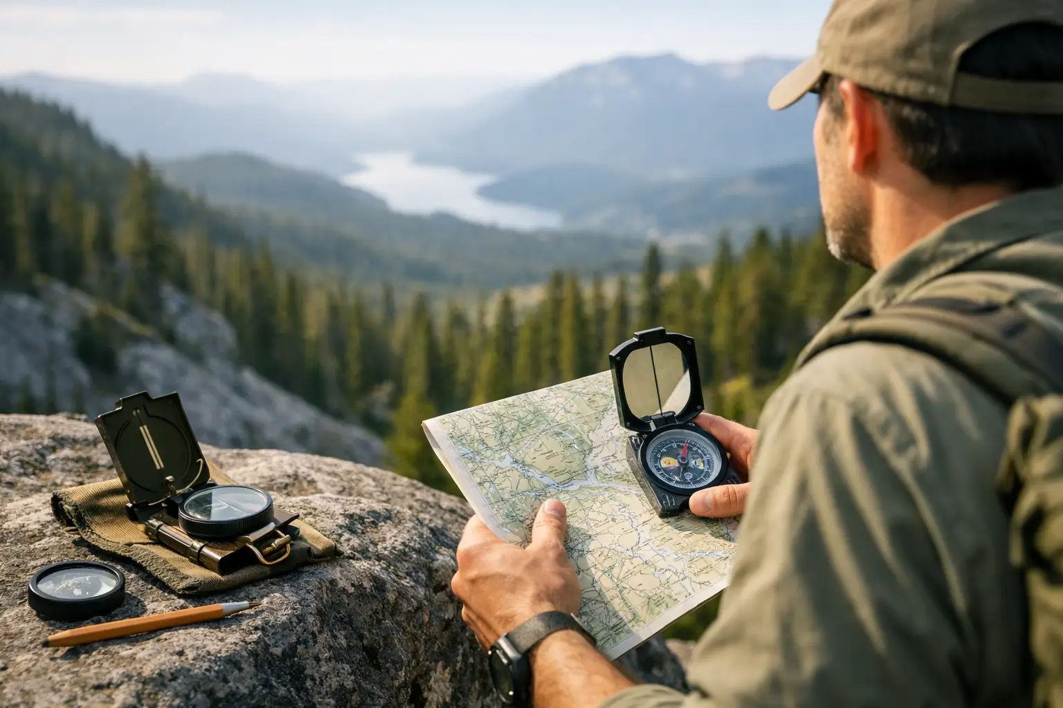
You do not need a big pack full of gadgets. For basic land navigation, carry a local topographic map in a waterproof sleeve, a quality baseplate compass with adjustable declination if possible, a pencil, and a small notebook. If you want one extra tool that earns its weight, add a pace bead set or just mark pace counts in your notebook.
This is one place where cheap gear can waste your time. A bargain-bin compass with a sticky needle or sloppy markings is not a deal. It is a liability. A good baseplate compass is simple, durable, and easy to read in cold, rain, or low light. The same goes for your map. Print quality matters. If contour lines, roads, creeks, and grid lines are hard to read, everything gets slower.
For beginners building a real-world kit, this is worth treating like any other core survival item. Buy once, test it, and keep it in your vehicle bag, hiking bag, or emergency kit.
Start with map orientation, not bearings
Before you worry about azimuths and backstops, learn to orient your map. That means lining the map up with the real world so north on the paper matches north on the ground. Once you do that, the shape of the land starts making sense. Hills, streams, roads, and clearings stop looking like abstract symbols and start looking usable.
Set your compass for local declination if your compass allows it. If it does not, you will need to account for declination manually, which is workable but slower. Then place the compass on the map, line up the baseplate with north-south grid lines, and rotate the map until the compass needle matches north. Now look around. If the creek is on your right and the ridge is ahead, that should match the map.
This sounds basic because it is. It is also the part most people skip. If your map is not oriented, every decision after that gets harder.
How to read terrain without getting buried in theory
Topographic maps tell you one thing better than anything else: shape. Contour lines show hills, draws, saddles, ridges, and valleys. You do not need to be a cartography nerd to use that. You just need to recognize what the ground is doing.
When lines are tight together, the slope is steep. When they spread out, the slope is gentler. Closed loops usually mean a hilltop or depression, depending on markings. V-shaped contours often point upstream in a valley or drainage. Ridgelines and valleys are your friends because they are easier to track than an invisible line through the woods.
This is where terrain association starts to beat pure compass walking. If you know your route follows a drainage north until it meets a road, that is often simpler and safer than trying to hold one exact bearing through brush for two miles. The trade-off is speed versus certainty. Dense woods, swampy ground, or private property boundaries can make the most obvious terrain route a bad call. It depends on the land.
Using a compass the simple way
A compass gives you direction. That is all. You still have to think.
Start by learning how to take a bearing from the map. Find your location and destination on the map. Lay the edge of your compass between those points. Rotate the housing until the orienting lines match the map’s north-south lines. Then read the bearing. Once you have it, hold the compass level, turn your body until the magnetic needle lines up with the orienting arrow, and pick a landmark in that direction.
Then walk to that landmark, not while staring at the compass the whole time. This matters more than people realize. If you keep your head down on the compass, you drift, trip, or miss obvious terrain clues. Pick a tree, rock, stump, or break in the brush ahead of you. Move to it. Then shoot the next point.
If visibility is poor, shorten the distance between checkpoints. In open country, you can move farther between them. Same tool, different method.
Backstops, handrails, and attack points
These three ideas make beginner navigation easier fast.
A backstop is a feature beyond your target that tells you when you have gone too far, like a road, river, or power line. A handrail is a linear feature you can follow, such as a fence, trail, or creek. An attack point is a big obvious feature near your destination that helps you make the final approach with less guesswork.
If your camp is 300 yards east of a creek bend, do not try to hit camp cold from a mile away. Navigate first to the creek bend, then turn east. That is cleaner, easier, and less prone to error.
Pace count is how you manage distance
Direction without distance is half a system. That is where pace count comes in. Count how many double steps it takes you to cover 100 meters on flat ground. Then repeat it on rough ground, uphill, and with your normal pack weight. Your number will change, and that matters.
You do not need perfect math. You need a realistic baseline. If you know your normal 100-meter count is around 62 double steps on flat ground, you can estimate distance well enough to know when you should be nearing a turn, trail crossing, or ridge spur.
Stress, darkness, mud, and thick brush all throw pace off. So use it as one input, not the only one. If your pace says you should have hit the creek already but the terrain says otherwise, stop and reassess before you push farther off line.
How to relocate when you know you are off
Everybody gets turned around at some point. The problem is not getting confused. The problem is pretending you are not.
When the ground stops matching the map, stop moving. That one choice prevents a lot of bad outcomes. Look for major terrain features you can identify with confidence. A ridgeline, road, creek junction, pond, saddle, or power cut is far more useful than random trees and vague impressions.
Then ask simple questions. What is the last place I knew for sure? Since then, what direction did I travel? Roughly how far? Did I cross any obvious features? Can I safely move to a handrail or backstop instead of forcing a direct line to my target?
This is also where a whistle, headlamp, and marking tape can support the process. They are not navigation tools by themselves, but they help you manage low light, regroup, and keep movement controlled when conditions get ugly.
Practice land navigation basics without GPS before you need them
Do not make your first no-electronics navigation day the same day things go sideways. Practice in a county park, on hunting land, around camp, or on public ground with clear boundaries. Start with short routes between obvious features. Work up to off-trail movement after you can orient a map and hold a bearing without drama.
Train with the gear you will actually carry. If your emergency bag lives in your truck, your map and compass should live there too. If you spend time in the backcountry, keep them in your daypack. Skills stick faster when the setup stays consistent.
There is also a strong case for redundancy. GPS is great when it works. Offline maps on a phone are useful. A dedicated GPS unit can be excellent. None of that replaces map-and-compass skill. It backs it up. Batteries die, screens break, and weather does not care what app you paid for.
If you want to be more prepared, land navigation is one of those rare skills that builds confidence immediately. Start small, carry dependable gear, and get reps in while the stakes are low. The day your electronics fail, you will be glad the basics are already second nature.